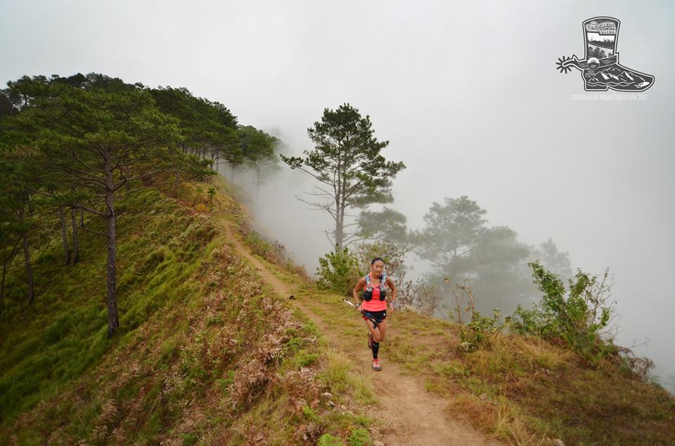
This community event is a great high mountain adventure for anyone who’s keen to see what Filipino trails are all about. It’s a fun challenging up-and-down course, well organised, lots of friendly local runners, and rewards you with some stunning scenery.

The race is doable in a weekend but it would be a bit of a mission - much better to take a leave day, or two or three if you can. If possible, we’d recommend flying into Clark over Manila, but both are decent drives at three or five hours to Baguio (add an extra 1-2 hours for public bus), and then it’s an extra hour to Itogon for the race start-finish. There are plenty of well priced hotels in Baguio, and Grab taxis are easy to get, even into the wee hours.
Simplistically, the course climbs one peak, drops down into a contour, ascends a second peak, and then returns downhill to the start. However, it’s never that simple, and the uphills undulate, as do the downhills.

Of note, the first sections are quite runnable, including a zippy downhill road section, some village run-throughs, and some vertigo-inducing contours. It’s probably a good thing we run this in the dark and can’t see over the edge!
After the first checkpoint, it’s mostly uphill, with some spectacular rugged mountain panoramas. This is the major climb of the race and it gets significantly steeper towards the top. Poles will definitely be helpful, especially on the slippery scree. With slopes up to 30 degrees, it’s very easy to push too hard here and pay later, so hold back and save those legs. The downhill section immediately following is also quite tricky for non-locals, but in a different way, given the steepness, lack of obvious trail (like fell running) and, again, the scree.
The next contour section is mostly runnable, with a few scrambles over the rock slides, before a steep climb to the second peak. From here, it’s all downhill - or is it? Given the large vertical extent of the course, the elevation chart can be a bit misleading and the 50-100m “bumps” can be easily missed on a quick view.
Definitely save some legs for the downhill - it’s easy to assume you can smash the uphills and roll down to the finish, but you’d be wrong. The downhill is mostly runnable but you’ll need quick feet to dodge the rocks and tree roots (like the last stage of Lavaredo), while there are a few little climbs lurking on the way.

Checkpoints are simple, with only water and rice plantains, which were surprisingly delicious and easy on the stomach. You could probably get by on these (note no rice at CP3) but most runners will want to bring their own backup nutrition. Take note that it’s 15km of mostly climbing between CP1 and CP2 so you’ll need at least 1.5L for this section.
In terms of race organisation, the course markings were excellent and we don’t know anyone that got lost, but would still recommend downloading the course GPX to your watch ahead of time. Additionally, the start-finish line had a good atmosphere, with a cooked meal included as part of your race entry, plus some delicious local pine ales for purchase.
Weather is definitely a factor, even in the Filipino “winter”. The weather should be quite pleasant for the 4am start and but temps can increase after the sun comes up at 6am. They peaked at 27C for us, but it felt warmer, particularly on some of the higher exposed sections. If you’re not used to the heat, crank back the pace and go a little slower to be safe. It’s easy to dehydrate unknowingly, as the humidity burns off with the morning sun and your sweat evaporates quickly. Don’t forget to apply a healthy dollop of sunscreen as the UV factor is up there in the high mountains.
Despite two of the T8 team, John Ellis and Mark Green, finishing in dehydrated messes at the 2019 event, we were proud to be represented by Kristian Joergensen (pipped for first in a bridge sprint finish by John “Stingray” Onifa), Koi Grey who blitzed the downhills and cruised into third, plus women’s champion Veronika Vadovicova, who lay down a marker for the 2019 Asia Trail Masters series!


